Tsunami risk with the island of La Palma (Canary Islands) 01
The slope on the volcano chain Cumbre Vieja is sliding since 1949 already...
presented by Michael Palomino (2020)
| Teilen/share: |
Facebook |
|
Twitter |
|
|
|
Summary: The predictable giant landslide on La Palma Island (Canary Islands) with a giant tsunami
These are the two geology volcanologists who are specialized scientifically with the connection between landslides and tsunami behavior:

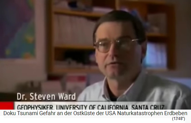
13) Volcanic geologist-tsunami researcher Mr. Simon Day, portrait - 15) Volcanic geologist-tsunami researcher Mr. Steven Ward, portrait
Volcanic islands have no solid rock, are like a "pile of gravel" with groundwater - when the water is heated by a volcanic eruption the island explodes
The Canaries, Hawaii and Cap Verde Islands etc. are large volcanic island groups, and during a volcanic eruption there ia always the potential for giant landslides. These islands are consisting of lava layers and lava stones which become very unstable with the time converting themselves into "piles of gravel". Rain water is collecting in these volcanos as groundwater and between the lava stones, the warmer the climate, the more rain and groundwater because clouds are flying higher and rain falls directly into the crater. From time to time there are volcanic eruptions, and when there is much water in a volcano, the heated water is expanding, is exploding and the complete island is blasted. The consequences are giant tsunamis with a devastation of complete coast lines and forming new layers. Such explosions of volcanic islands happened also in Japan and near new Guinea (the explosion of Ritter Island) [and also the explosion of Santorin in Greece with the devastation of Crete was such a case].
0) Map of the Canary Islands with 8 major landslides in 1 million years, 3 are older - every major landslide represents a gigantic tsunami [6]
1949: Volcanic eruption on La Palma (Canary Islands) - formation of a 4.8km long crack - the landslide zone: slide of the western volcanic flank 1cm per year - with a new volcanic eruption everything will slide into the sea + tsunami risk
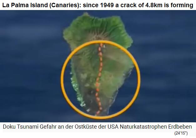
In 1949 there was a volcanic outbreak on La Palma Island (Canary Islands) with a long lasting eruption forming many new little craters. Since then on the southern part of the island a crack of 4.8km has been formed along the volcanic chain "Cumbre Vieja", and this crack (estate of the video 2016) has become 4.5m wide, the slide zone is moving 1cm per year. Volcano professors Ward and Simon Day are warning that with a new volcanic eruption on La Palma Island with much water in the volcano, there is a big danger that the slide zone on the western volcanic flank is blast and sliding into the Atlantic (16km long, 1600m high, 300m deep). This would provoke a giant tsunami. This can happen at any time.
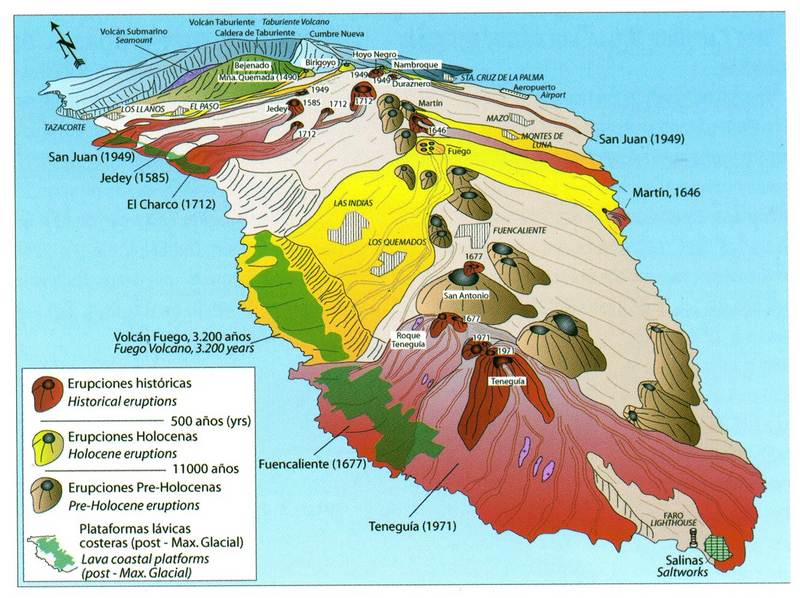
The last volcanic eruption on La Palma was in 1971 on the volcanic chain of the Cumbre Vieja at the southern tip (Roque Teneguía):
27) Map of the island of La Palma with volcanic eruptions with dates [3]
Translation:
The ridge of the Cumbre Vieja consists of a series of volcanic cones, eruption centers and crevices, which are typical for rift volcanoes (fig. 3). The most important eruption points from north to south are (fig. 6 and 7):
> the Montagna Quemada or Tacande (eruption 1470-1492),
> the Pico Birigoyo (eruption approx. 4000 BC),
> the Pico Nambroque (eruption approx. 1000),
> the Volcan Llano del Banco or San Juan (eruption 1949),
> the Volcan Jedey or Tajuya (eruption 1585),
> the Crater Hoyo Negro (eruption 1949),
> the Crater Duraznero (eruption 1949),
> the Volcanes la Deseada I and II (eruptions approx. 5-6000 BC, Deseada I is at 1,949 m above sea level the highest point on the Cumbre Vieja),
> the Volcan el Charco (eruption 1712),
> the Volcan Martin (eruptions prehistoric and 1646),
> the Volcan San Antonio (eruptions around 1200 BC and 1677)
> and the Volcan Teneguia (eruption 1971), at 427 m above sea level. NN the deepest eruption point of the Cumbre. [web01]

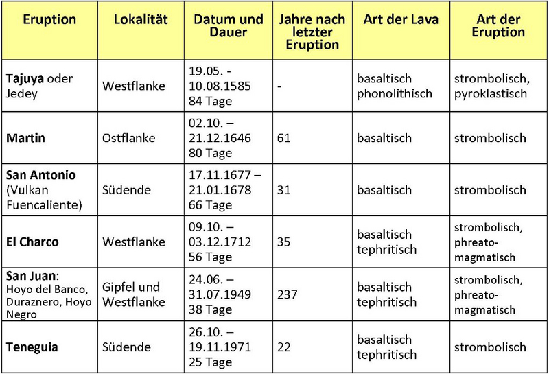
30) Map of the southern tip of the island of La Palma with volcanic eruptions [5] - 29) Table of volcanic eruptions on La Palma since the Spanish occupation [4]
The eruption and tsunami computer model of Prof. Ward and Prof. Simon Day
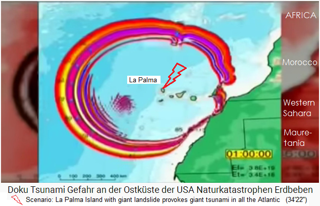
The volcanic geologists Prof. Ward and Prof. Simon Day collected data from their investigations from exploded volcano islands (Hawaii and Ritter Island near New Guinea), and with the collected data they composed a computer model how the landslides and tsunamis are behaving. For La Palma, the professors are predicting the following scenario: When the west flank of the volcanic chain Cumbre Vieja of La Palma Island is sliding into the sea, this will trigger a giant tsunami in all directions: There will be affected: all the coast of West Africa, all the Atlantic Coast line of Europe, Mediterranean, and all the East Coast of "America" with Caribbean inclusive. Flat coast lines of "America" will let pass the tsunamis up to 20km to the inner of the country. High cliffs like in Ireland or partly also in Spain and France are better in this case defending the tsunami well.

17) The map with the tsunamis caused by the explosion of Ritter Island near New Guinea in 1888 - 9) Computer model with the tsunami when the western flank of the Cumbre Vieja of La Palma Island is sliding into the sea
All coastal cities in Morocco, West Africa, in Europe from Spain to England, the entire Mediterranean area, Madeira, and the entire east coast of "America" including the Caribbean are threatened.
Comment: Remove the land slide of the volcano chain Cumbre Vieja!
The landslide zone on La Palma Island has to be removed BEFORE something is exploding and "goes swimming"! "USA" know how to blow complete mountains or removing them for getting access to coal mines. Why this procedure is not applied on La Palma Island? (see the web site: mountain murder - link)
Michael Palomino, August 27, 2020
Details
27.8.2020: La Palma Cumbre Vieja in the Canaries: The volcano becomes a pile of gravel - fills with water, explodes during the next volcanic eruption and provokes tsunamis for 5 hours
Video: Documentary Tsunami danger on the east coast of the USA Natural disasters earthquakes (44'16 '')
(original German: Doku Tsunami Gefahr an der Ostküste der USA Naturkatastrophen Erdbeben)
Video: Documentary Tsunami danger on the east coast of the USA Natural disasters earthquakes (44'16 '')
(original German: Doku Tsunami Gefahr an der Ostküste der USA Naturkatastrophen Erdbeben)
https://www.youtube.com/watch?v=nLyUbGMc6Rs - YouTube channel: Celia Aaron- installed on Feb.15, 2016
La Palma Island with the "Cumbre Vieja": The landslide is already in progress with an almost 5km long crack
The cause of the tsunami which will go against the east coast of the "USA" is the volcano on La Palma Island, this is a island of the Canary Islands near the African coast line, Canary Islands are part of Spain (2'12''). La Palma Island has got an active volcano chain "Cumbre vieja" ["Old Top"] (2'17''). [Along this volcano chain] on the island an almost 5km long crack has formed from the north to the south (2'35''). When the volcano should outbreak, a complete part of the island could detach and fall into the sea, the slide zone of the volcanic flank is 16km long and 1600m high (2'55''). This could provoke a tsunami with an initial height of 300m (3'0'').


1) La Palma island, aerial view: This small volcanic island endangers the whole world: landslide 4.8km, tsunami across the Atlantic, 20 tsunami waves -
2) The Canary Islands with La Palma with the volcanic chain Cumbre Vieja
3) Since the volcanic eruption of 1949, a 4.8 km long crack has formed on La Palma Island along the Cumbre Vieja volcanic chain

4) With the next volcanic eruption on La Palma Island it's probable that the complete western flank of the Cumbre Vieja will break away sliding into the sea provoking a 300m high tsunami as a result
5) Animated film: When the next volcanic eruption on La Palma, the western flank of the island breaks away
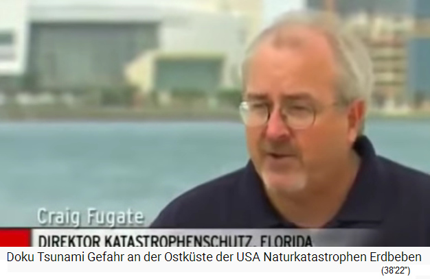
The La Palma tsunami can reach the east coast of the "USA" in 10 hours, there will be a 25m high tsunami in Boston, New York, Miami (3'45 ''). Mr. Craig Fugate (the Florida Civil Protection Director): This is going to be a global event with worldwide repercussions (4'0 '').
Example: The Hawaii volcanic islands with landslide tsunamis: Nuuanu - Alika 1 - Alika 2: Conclusions for La Palma + the "US" east coast
There are investigated examples of landslides that have caused tsunamis: on Hawaii (4'24 ''): The geochemist Dr. Gary McMurtry from the University of Hawaii says: On Hawaii there were always landslides, including underground landslides, which then triggered tsunamis (4'49 ''). Around the Hawaiian Islands there are over 60 fields of debris from landslides, e.g. in front of the island of O'ahu [Honolulu], where huge rocks are piling up on the sea floor, the largest rock that came down is 48 km long, it fell into the sea 2 million years ago (5'19 ''). The tsunami on today's "US" west coast was 30 to 90m high (5'27 ''). So this was a 30 stores high wave against the region where today are Los Angeles and San Diego, 2 million years ago nobody was there (6'43 '').

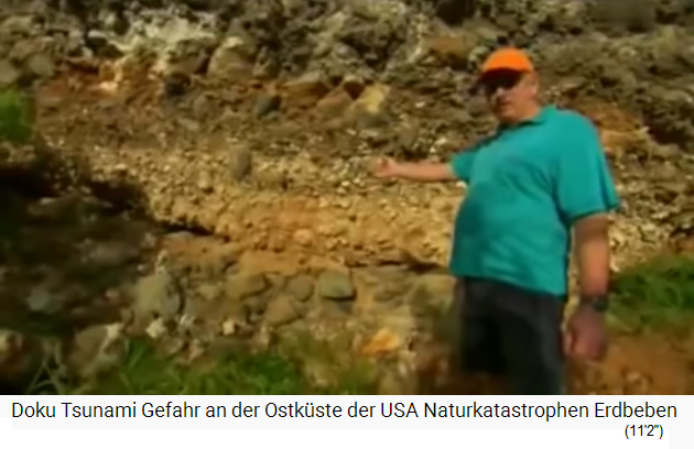
6) Hawaii Big Island with landslide and tsunamis Alika I and Alika II (map of all Hawaiian Islands Link - map of the 8 big Hawaiian Islands Link)
7) Dr. Gary McMurtry in Hawaii is indicating: on the smaller islands there are sediments from 2 giant tsunamis
8) Dr. Gary McMurtry in Hawaii is indicating: Big stones from a third tsunami wave of the tsunami "Alika I"
In the meantime, the landslides around Hawaii have been mapped, the marine geophysicist Dr. John Smith from the University of Hawaii says: First measurements are taken from above with sonar from a ship, then a small submarine comes, then samples are taken (7'8 ''). This is how the maps with the landslides are created, and conclusions about previous landslides and tsunamis are possible (7'42 ''). First there was the landslide with the Nu'uanu tsunami (a landslide on the sea floor [web03]), then two landslides followed from the main island: "Alika I" 240,000 years ago, and "Alika II" 120,000 years ago (each time complete mountain slopes of the Volcano "Mauna Loa" were falling into the sea [web02]) (8'0 ''). Both were triggered by landslides on the west coast of the Big Island (8'5 ''). Twice over 2000km3 of rock fell into the sea (8'20 '').
The explosion at Mount Helens was only 1/500 of the amount as in Hawaii (8'27 '').
40) The 1980 explosion at Mount Saint Helens volcano with a rock and mud avalanche
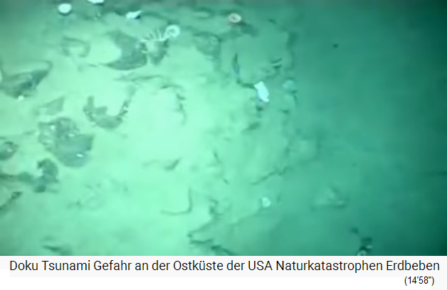
The debris fields on the ocean floor off Hawaii go down to 4000m deep (8'38 ''), so the rocks that fell down there are partly rocks as high as houses (8'43 ''). The tsunami hit the island of Lanai, 160 km north of Big Island, the tsunami was 180 to 300 m high, these high tsunami waves acted like rain, not only with sea water, but also with large rocks from the sea floor, with fish, seaweed, shells and sand (9 '18' '). So there are deposits that can be precisely dated, and now one can conclude what would happen if a gigantic wave hit the east coast of the "USA" (9'40 '').
There were several tsunami waves, white or brown because of the sediments in the tsunami (10'0 ''). The two tsunamis of Alika 1 and Alika 2 left different layers of sediment, the Alika2 layer is on top (120,000 years old), the Alika1 layer is below (240,000 years old) (10'55 ''). This type of deposits can be found all over the world (10'59''). The cause for giant tsunamis is mostly the collapse of a volcano, which then partially crashed into the sea and thus provoked giant tsunamis (11'2 '').
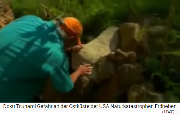
3 different Alika 1 deposits: The first wave brought large boulders, mainly from the sea. The second wave brought a mixture of sea material and land material (11'17 ''). The third wave brought some big boulders and a lot of shells, a total chaos (11'39 '').
La Palma Island threatens the "US" east coast, the Bahamas, Cuba and the Dominican Republic
By the way, the Bahamas, Cuba and the Dominican Republic would also be affected by a La Palma tsunami, which would be caused by a collapse of La Palma (12'2 ''). When the mountain flank on the island of La Palma falls into the sea, the "USA" will be hit and it will take years to recover (12'14 '').

9) Computer model of a gigantic tsunami after the crash of the western flank of Cumbre Vieja on La Palma -
10) Computer model with the La Palma tsunami against Florida and the Caribbean (Cuba, Dominican Republic, Haiti, Bahamas)
90m high waves on the "American" west coast
The tsunamis that came from Hawaii (Nu'uanu tsunami and Alika I + II) reached the west coast of North and South "America" with waves 90m high (12'52 '').
Recent examples of landslide tsunamis: Hawaii 1946 - Alaska 1964
Hawaii was hit in 1946, Alaska in 1964 (13'8 '').
Case: Hawaii 1946: There was a sea quake on the sea ground near the Aleutian Islands near Alaska, during which the sea floor was raised, and this provoked a tsunami wave against Hawaii [web04]. This sea quake had a strength of 8.6, the sea floor was raised and the tsunami wave in Hawaii was 45 to 130 feet high (13.7 to 39.6m) [web07].
Case: Alaska 1964: An earthquake of magnitude 9.2 with landslides on Alaska into a fjord provoked tsunamis up to 67m high in the fjords of Prince William Sound and in the fjords of the Kenai Peninsula [web05]. Landslides destroyed whole villages, and underwater landslides provoked tsunamis [web06].
Case in 1888: New Guinea: The data of the explosion of "Ritter Island" as the basis for the new computer model
Ritter Island near Papua New Guinea had a volcanic eruption in 1888, this little volcano collapsed provoking a tsunami in all directions. Dr. Simon Day: The colonists of then made drawings of the old island, today only a little hull has remained (13'37''). Dr. Steven Ward: 95% of the island fell into the sea, the tsunami was 9 to 15 meters high and destroyed the coast lines around provoking 3.000 deads (13'59'').


11) Map of New Guinea with Ritter Island - 12) Ritter Island near New Guinea before the explosion, drawing 1880 appr. - 14) Ritter Island near New Guinea in 2016 approx., only a hull has left
The main volcanologist tsunami researchers Dr. Simon Day and Dr. Steven Ward

13) Volcanic geologist tsunami researcher Simon Day, portrait - 15) Volcanic geologist tsunami researcher Steven Ward, portrait


16 + 17) Map with the Ritter Island and the tsunami of 1888 (1: after 22 minutes - 2: after 36 minutes)
The effects of the tsunami: The vegetation on the coast was partially torn away by the tsunami waves, a bare strip remained without trees, and Ritter Island became a focus of tsunami research (14'25 ''). Researcher in this field is for example Dr. Simon Day, the debris field in front of the island is being mapped. Film speaker: The data allow the conclusion that the rubble hit the sea surface at 160km / h (15'11 ''). The extent, shape and speed of the landslide can be derived from data research (15'20 '').

18) New Guinea region, indigenous peoples' stilt houses - 19) Ritter Island, the rock avalanches of 1888 on the sea floor
Dr. Simon Day: Jesus fantasy missionaries who had their mission stations on hills and who survived also made records, and this data can be evaluated (15'29 ''). Film speaker: The invasion with Jesus fantasy missionaries came in 1888 shortly before the explosion of Ritter Island, there were hardly any people living there at that time (15'44 ''). The data from the Jesus fantasy missions in the surrounding area can be used and, when combined, the result is a reliable overall picture for predicting future tsunamis (15'59 ''). With the help of their pocket watches, the Jesus fantasy missionaries were able to precisely note the timing - important for research (16'13 '').
20) The Jesus fantasy colonialists in the New Guinea region were able to record the tsunamis precisely with pocket watches
Cases: Japan with landslide tsunamis
Other volcanoes that exploded, collapsed and triggered tsunamis were e.g. in Japan 1640, 1741 and 1792 (16'29 '').
So the Jesus fantasy colonialists lived in the area around Ritter Island with their pocket watches and noted exactly which tsunami wave arrived when and at what height (16'57 ''). Research on Ritter Island can reconstruct exactly when which neighboring island was reached by the tsunamis (17'38 ''). A computer model was developed with this data, and now the researchers believe that they could predict tsunamis (17'59 ''). Accordingly, it is like this: If the volcano on the Canary Island of La Palma collapses and falls into the sea, then the coasts of Africa, Europe and "America" are very endangered (18'16 '').
Cases: Landslide tsunamis that hit North "America": Newfoundland in 1929 + Valdez in Alaska in 1964
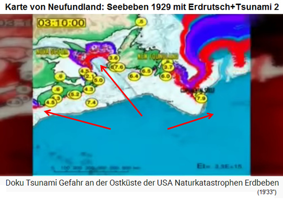
Landslide tsunamis that hit North "America" are so far: The Grand Banks Tsunami of 1929 in Eastern Canada (18'38 ''), the Newfoundland Bank Tsunami: First there was an earthquake with a magnitude of 7.2, then came the landslide on the seabed, then came the tsunami (19 '23''). The tsunami wave can reach the same height as the landslide itself (19'31 ''). In addition, the landslide also cut the transatlantic cables from N- "America" to Europe (19'43 ''), the armored cables were cut like twine (19'54 ''). The tsunami then went in the direction of the New In Peninsula [?] on Canadian territory, 800km fast (20'9 ''). The wave slows down near the coast, at the same time increases in height (20'15 ''). 50 km of coast line were hit, 27 dead, 10,000 houses destroyed (20'38 '').
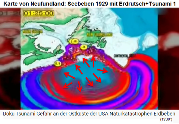
21 + 22) Map of Newfoundland with the seaquake of 1929 with landslide on the sea floor with tsunamis 1: after 1h26min., - 2: after 3h10min.
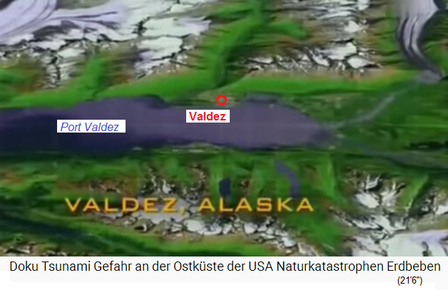
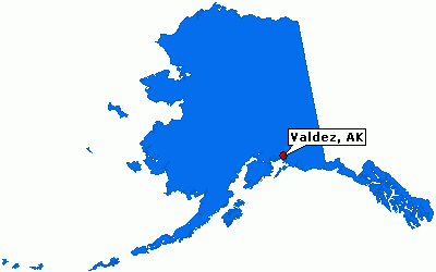
In Alaska in 1964, there was a tsunami in Valdez: first came an earthquake of 8.4 and then an underground landslide that triggered a tsunami (21'28 ''), the port of Valdez was totally destroyed with an area of 1200 by 800 meters, 30 dead, including many children, exploded oil tanks, etc. (22'6 '').
Dangerous groups of volcanic islands on planet Earth are: The Canaries, Hawaii, Cap Verde
The greatest risks today (as of 2016) are: the Canaries with the volcano chain Cumbre Vieja: there is the greatest risk today. The volcanic islands of Hawaii and Cap Verden also have the potential to provoke gigantic landslides (22'39 '').
La Palma "Cumbre Vieja": 4.8km long crack - the land mass: 16km long, 1600m thick - the island is totally 5400m high

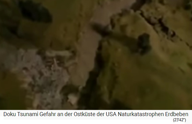
25) La Palma island of the Canaries, the volcanic chain "Cumbre Vieja" - 31) Animated film: La Palma island, the crack at the volcanic chain "Cumbre Vieja", aerial view - 33) La Palma island: The crack along the volcanic chain "Cumbre Vieja" is 4 , 8km long
A landslide on the flank of La Palma Cumbre Vieja would first destroy the entire Atlantic coast of Morocco, Spain, Portugal and France, then also reach Ireland and England, and then the Bahamas, "USA", Canada, Brasil, Santo Domingo, Haiti, Cuba, in the end too still Mexico etc. (22'59 ''). The island of La Palma is approx. 5000 km away from the "USA". The 4.8 km long crack on the island is extremely explosive. The crack is 4.5 m wide, and with this, the western side of the volcano is moving already towards the sea (23'45 ''). When the volcano on La Palma Island explodes, a rock mass 16km long and 1600 thick breaks into the sea (24'23 ''). The tsunami would destroy the Atlantic coasts of West Africa, Europe, North "America" and South "America" (24'43 '').
The Canaries are volcanic islands, the island of La Palma begins 3600m below sea level and ends on 1800m above sea level, a total of 5400m of height (25'22 '').
[Thus the landmass of the sliding zone not only falls into the sea, but in the sea is falling 3600m more!]
37) The island of La Palma with 3600m under water, 1800m above water, the volcanic island is in total 5400m high
Structure of volcanic islands: lava sediments + lava rocks = "piles of gravel" - a few volcanic eruptions on Cumbre Vieja up to 1712
Volcanoes are built up from lava sediments and lava rocks. By the time, volcanoes become "unstable like a pile of gravel" (25'40 ''). At Cumbre Vieja there were many eruptions already, e.g. in 1470, 1585, 1646, 1677, 1712 and 1949 [and 1971] and these outbreaks followed always the same pattern (25'55 '').
Volcanic Islands: Rainfalls increase the water pressure in the volcano
The rain plays a certain role here, because the water pressure is often decisive: landslides on volcanoes often occur after rainfall because the water pressure between the stones is then increased (26'19 '').
So: volcanoes are always porous ["like a pile of gravel"], the rainwater collects in them, volcanoes are like gigantic sponges that fill with the rainwater (26'36 ''). The volcanic rock ABOVE sea level is saturated with water from rain, the volcanic rock becomes heavier and this increases instability. The volcanic rock BELOW sea level is not only saturated with water, but all cavities are filled with sea water. When a volcanic eruption occurs, the rock is heated by the lava, the water boils, turns into steam and everything explodes. A sea volcano is like a pressure cooker (27'20 '').
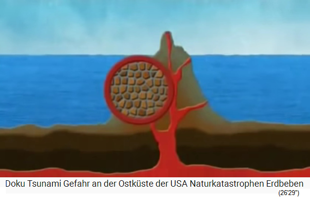
38) In the underwater part, the porous volcanic island of La Palma is filled with seawater -
39) The porous volcanic island of La Palma with a volcanic eruption: the water turns into steam, expands and the island becomes like a pressure cooker
1949: 7 days of heating and volcanic eruptions caused the 4.8km long crack - 400km3 of material
The mountain flank of the island of La Palma has been destabilized since 1949, when the groundwater was heated during 7 days and the pressure increased, so that a 4.8km long crack was created (27'33 ''), and now [as of 2016], just one more earthquake is needed and the entire slope could slide down and "go swimming" (27'43 '').
[The 1971 volcanic eruption on Cumbre Vieja is not mentioned in the film].At Mount Saint Hellens it was a few km3 that flowed into the valley in a few minutes, the landslide to be feared on La Palma would be 200 times larger and would take 4 hours (28'6 '').
Volcano geologist Simon Day: La Palma is one of the steepest places on earth. It's about 400km3 of material, the released energy is incredibly high, the slope is very steep, the acceleration can go up to 300 or 500km / h (28'48 ''). [Thus the earth slide will not last 4 hours...]
41) La Palma Island: The scenario with a landslide on the western flank of Cumbre Vieja
Movie speaker: When the landslide of La Palma triggers a tsunami (water mountain) it will spread on the Atlantic with 800km/h, the Canaries will be "covered" in 30 minutes (28'57''). One after the other the coast of Africa, Europe, the Mediterranean Sea and "America" are affected, the scientists assume 20 gigantic waves against the "American" coast line (29'37 '').

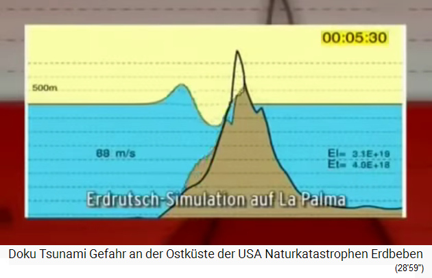
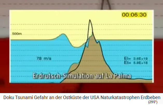
42-44) Computer model cross-section with the landslide and tsunami wave from La Palma 1,2,3

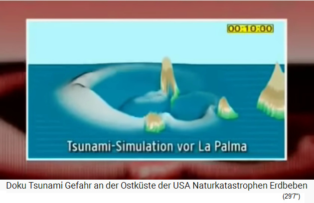
45) Computer model cross-section with the landslide and tsunami wave from La Palma 04 - 46) 3-dimensional computer model with the landslide and tsunami wave from La Palma

47) Map with the computer simulation of landslide + tsunami from La Palma against all other islands after 13min.30sec.
48) Map with the computer simulation of landslide + tsunami from La Palma, the African coast is reached (1 hour 0 min. after the landslide)
So: some time it will rumble in the volcano Cumbre Vieja, then an eruption follows accompanied by earthquakes, the almost 5km long crack opens, the mountainside slides into the sea and provokes a gigantic tsunami (31'18 '').

50) Map with the island of La Palma with the sliding slope on the western flank of the volcanic chain "Cumbre Vieja"
The big politics will long discuss whether one should evacuate - 830km3 of rock
Before that, the volcanic wall threatens to collapse, as happened on Ritter Island. Shortly before the collapse of the volcanic wall on La Palma, the big discussion in politics will arise whether the coasts on the Atlantic should be evacuated or not (32'14 ''). When the slope breaks off, rocks break and there is no more resistance. If the water pressure is maintained, a giant rockslide is possible now (32'41 ''). Narrator: The west side of the volcano descends 6m, then the rock face (16km length + 300m thick) slides into the sea, that is 830km3 of rocks, plunges into the sea [and down to the seabed, so about 5200m difference in altitude] and provokes a 300m high wave around the island (33'7 '').
Cumbre Vieja explodes on La Palma: The affected coasts: West Africa - Caribbean - "USA" - save yourself in high buildings - several tsunami waves
West Africa's coast is hit by a 90m high tsunami (33'27 ''). Bye bye Casablanca (33'39 '').
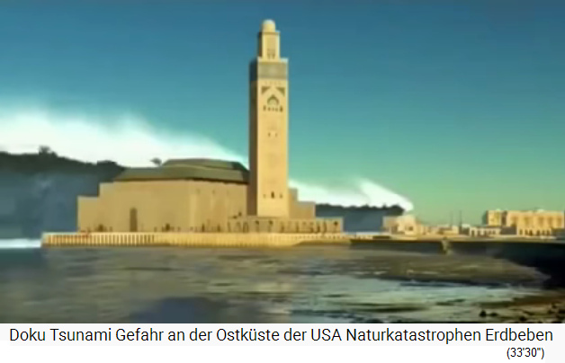
49) Animated film: The La Palma tsunami will reach and destroy Casablanca in Morocco [the same applies to Freetown, Cadiz, Malaga, Marseilles, Rome, Tunis, Lisbon, Porto, Vigo, Bordeaux, London, Liverpool, possibly even The Hague, Antwerp, Bremen, Hamburg etc.]
On the beach, the tsunami wave grows 3 to 4 times, this is the case also with normal waves (34'7 ''). A 10m high wave on the ocean will be 30m high (34'11 '') on the beach, so it will be in "America" with 9 to 30m high waves - not all scientists believe that, but those who studied the tsunamis around Ritter Island know that it will be like this (34'40 ''). 9 hours after the landslide, the Bermudas are destroyed with 27m high waves, including the Bahamas (34'55 ''). 10 hours after the landslide, the entire east coast of the "USA" is on the line (35'5 ''). The "USA" have exactly 10 hours for the evacuation from the collapse of the island of La Palma, the people have to save themselves in high buildings (36'39 '').
Simon Day and Steven Ward's computer model shows the following times:

9) Computer model of a gigantic tsunami after the crash of the western flank of Cumbre Vieja on La Palma -
51) Map with the computer model of the La Palma tsunami off the coast of "America" and Brasil

52) Map with the computer model of the La Palma tsunami: impact on the coasts of Canada, northern "US" states and Brazil, Suriname, Guiana, Venezuela, Puerto Rico, Dominican Republic, Haiti, eastern Cuba
10) Computer model with the La Palma tsunami against Florida and the Caribbean (Cuba, Dominican Republic, Haiti, Bahamas)
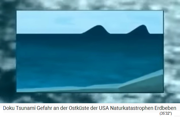

53) Animated film: Tsunami waves in the bank area are getting closer and closer
54) When big tsunamis come to Florida, people have to escape to the skyscrapers
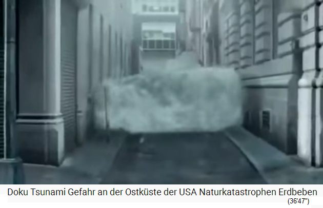
55) Animated film: Tsunami in New York fills street canyons
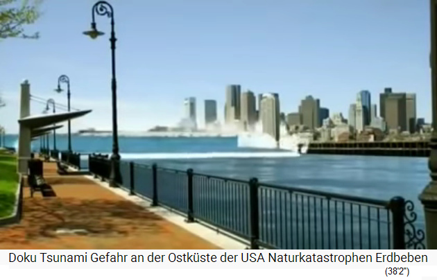
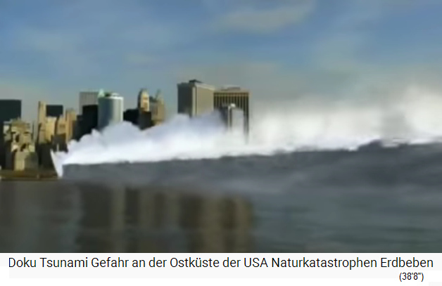
56) Animated film: Boston with tsunami - 57) Animated film: New York Lower Manhattan with tsunami - 58) Mr. Craig Fugate, the Florida Civil Protection Director
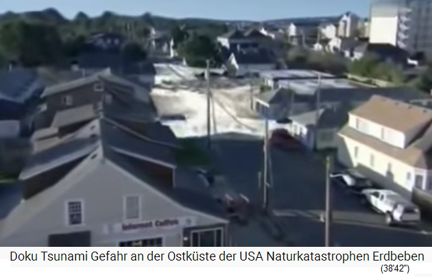
59) Animated film: The coastal towns on the "US" east coast are drowning in tsunami waves
The island chain of the "Outer Banks" off North Carolina is flooded (37'41 ''). The tsunami consists of several waves, the first does not even have to be the largest, the tsunami wave is full of mud and rubbish, people are "swept away" (38'38 ''). The first wave can be for example up to 12m high, then the water will withdraw for 30 minutes. In total, there can be up to 12 waves that flow in and flow back (39'0 ''). The second wave destroys what the first wave has not yet destroyed, there can be 20 waves in a back and forth during 5 hours (39'25 '').
In Florida, 8.5 million people live in the danger zone (39'41 ''). Miami and Date County are located in a low-lying area with a population of 2.5 million (39'58 ''). The water power at 32km / h is 13 tons for each person (40'26 ''). Miami will have major evacuation problems (41'4 ''). After 5 hours of tsunami waves, thirst, hunger and water pollution follow, and the reconstruction will then take years, the "USA" will for the first time be dependent on international aid on a large scale (42'43 '').
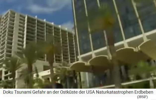

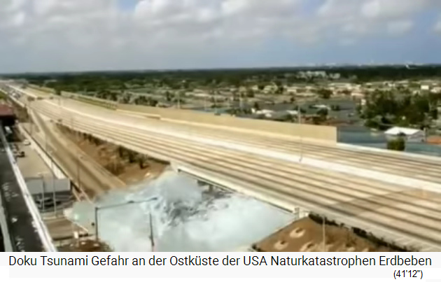
60) Miami has a tsunami problem - 61) Animated film: Miami with tsunami - 62) Animated film: Miami with the interstate highway and the tsunami comes through open barn doors (why they cannot be closed?)
Idea: remove the sliding slope on La Palma!
Idea: You have to remove the western flank of the Cumbre Vieja on La Palma, BEFORE something "goes swimming"! The "USA" know how to blast away or remove entire mountains in order to get new access to coal mines. This procedure can also be used on La Palma. In addition, tsunami protection is possible on the Atlantic coasts.
Michael Palomino, Aug.29, 2020
========
Aug.27, 2020: Data and facts on the tsunami threat from the volcanic island of La Palma - time bomb!
Video: MEGATSUNAMI DOCUMENTARY PART 1 (7'46'')
Video: MEGATSUNAMI DOCUMENTARY PART 1 (7'46'')
https://www.youtube.com/watch?v=Fzm49fUSCPk - YouTube channel: Thom Goddard - [no date of installation]
-- Prof. Bill McGuire
-- Dr. Simon Day
-- Dr. Mark Maslin
A time bomb is ticking: mega-tsunami against the east coast of the "USA" - 200km3 of rock fall into the Atlantic
Film by Thom Goddard (1'9 ''). 50 million people live on the east coast of the "USA" from Boston to Miami, they are threatened by a geological time bomb (1'23 ''). Prof. Bill McGuire: Well, there comes an atomic bomb with the speed of a jumbo jet and nothing will be left (1'33 ''). Dr. Simon Day: Tsunamis can end up being several stories high on the beach and pulling up to 20km inland (2'0 ''). Dr. Mark Maslin: Everything will be destroyed, New York, Miami, Bahamas (2'5 ''). Prof. Bill McGuire: From the Canary Islands to "America" there will be about 8 hours, from New York to Miami all coastal cities will be destroyed, including the Bahamas and the Caribbean, millions of deaths and gigantic destruction are possible (2'35 '').
Dr. Simon Day: These megatsunamis can get up to 1km high and are triggered by landslides (2'45 ''). Speaker: So first there is an earthquake, then a landslide into the sea [sliding to the ground of the sea down to 6000m deep], and then the tsunami is provoked, often up to 20m high at the end (3'0''). A mega-tsunami, however, is much higher: Prof. Bill McGuire: The issue here [on the volcanic island of La Palma] is about 200km3 of rock material that threatens to fall into the Atlantic, and that causes a much higher tsunami than just an earthquake, when the seabed is shaken a little (3'33 '').
Volcanic islands: Magma is rising - groundwater in the volcano heats up - the vapor pressure blows the whole island apart
Dr. Simon Day: The research clearly came to the conclusion that after a volcanic eruption the giant landslides are triggered (3'52 ''). When the lava rises, the flank of the volcano is blasted off by heating the groundwater in the volcano and the steam pressure then bursts the mountain exactly where there is a weak point (4'11 ''). A whole mountain side then slides into the ocean and triggers a mega tsunami (4'20 '').
The flat east coast of the "USA" allows tsunamis to penetrate far inland
The Chesapeake Bay intensifies the tsunami against Washington DC and against Philadelphia (4'31 ''). Prof. Bill McGuire: The tsunamis are getting smaller or bigger, it depends on the shape of the coastline and how flat the coastline is, so on a flat coast tsunamis can penetrate for kilometers inland (4'40 ''). In a bay or river mouth, the wave can intensify, get higher and higher and destroy entire harbors (4'51 ''). With high cliffs, however, the tsunami does not go so far inland (4'55 ''). Dr. Mark Maslin: The starting point of this super tsunami is the volcanic island of La Palma in the Canaries (5'5 ''). With a new volcanic eruption, half of the island of La Palma can crash into the sea and trigger a 600m high tsunami (5'14 ''). Prof. Bill McGuire: So the Canaries are all active volcanoes, on La Palma there are three volcanoes, and from time to time they collapse and then provoke gigantic tsunamis (5'28 '').
So: Normal earthquakes can cause tsunamis up to 20m high, but in the case of the island of La Palma, if half the island falls into the sea, then the tsunami will be up to 600m (2000 feet) high (5'44 ''), on the "US" east coast the tsunami will still be 50 to 150m high, so as high as the Statue of Liberty or half as high as the Eiffel Tower (5'49 '').
Japan 1741: volcanic island of Oshawa Oshima explodes
Dr. Simon Day: There have already been volcanic islands that have slid into the sea, in Japan there was one in 1741, Oshawa Oshima, which then resulted in a tsunami in the Sea of Japan (6'10 ''). But that was a rather small event (6'12 '').
Giga explosions from volcanic islands always occur during extreme warm phases of the earth
The big landslides with millions of km3 of material occur every 20,000 years, and we think that the collapse of volcanic islands also happen in groups (6'31 ''). Dr. Mark Maslin: These volcanic island explosions always occur during extreme warm phases of the earth (6'51 '').
End of the movie. Credits:
Executive Producers: Matt Gordon & Richard Wiese (7'4 ''). Film script, production and direction by Thom Goddard (7'9 ''). [Company]: From Earth & Space - earthandspace.now.com (7'28 '')
========
Lava is rising - ground water is heated - the island is exploding provoking a giant tsunami - "USA" are not prepared
Video: MEGATSUNAMI DOCUMENTARY PART 2 (6'54'')
Video: MEGATSUNAMI DOCUMENTARY PART 2 (6'54'')
https://www.youtube.com/watch?v=z06bFOLaNI0 - YouTube channel: Thom Goddard - [no date of installment]
Water plays a major role in these volcanic island explosions (1'17 '').
Dr. Simon Day: During warm periods on earth with a more warm and humid climates it's raining more, the ground water tables in the volcanoes are higher, and then the explosions and volcanic islands are collapsing more likely. Well, we are currently living in such a warm period (1'28 '').
Water in the volcano in the pipe systems
Dr. Mark Maslin: Well, the Canary Islands are a very special region, and the water is the cause of the collapse of volcanic islands (1'39 ''). When rain falls into the volcanic funnel, it is collected in the impermeable pipe systems that were created there by previous volcanic eruptions (1'50 ''). When a new volcanic eruption occurs, the magma heats this water, the water expands and bursts the island, so that half of it falls into the sea (2'3 '').
La Palma Island can break up tomorrow or in 10,000 years
What is the probability that La Palma will explode? Prof. Bill McGuire: Actually, the probability is 100% (2'14 ''). The flank will certainly fall into the sea, the only question is, will that happen in a short time or in a few 10,000 years (2'34 ''). In any case, there has to be a volcanic eruption as a prerequisite, it can be in one year, or in 1000 years, we don't know, but in geological dimensions that will soon be the case (2'49 '').
La Palma: First comes a volcanic eruption - then the crack will break open - weeks or months for the evacuations
Dr. Simon Day: The magma will push the mountain flank into the sea, or the groundwater pressure will push the mountain flank downwards, and scientists can then predict the collapse weeks or months in advance (3'28 ''). This leaves a few weeks or months for the evacuation (3'33 ''). Prof. Bill McGuire: Our assumption is clear: Before the collapse of the island flank there will be a volcanic eruption, and then the observation will be focused on La Palma, whether the mountain flank begins to slide (3'51 ''), and if it appears that this does not stop any more, then the evacuations in the "USA" will begin inland, as with the hurricanes (4'4 '').
"USA": The disaster planning is not prepared for a mega-tsunami from La Palma
To date there are no plans for such a tsunami, so something should be done in the "USA" disaster planning, otherwise a high death rate will be accepted (4'35 '').
Correlation: The warmer the climate - the higher the clouds fly - the more rain reaches the volcanic center
Speaker: Air pollution is a factor in global warming [FALSE: Solar activity and the position in relation to the sun are responsible for global warming]. Dr. Mark Maslin: For rain in the center of the island high sea temperatures are needed, until today there are the beaches, then the jungle, and in the center the island is a desert (4'59 ''). If the ocean temperature now rises, empirical values show that the cloud height rises and the transported heat rises, so that the clouds also rain down over the center of the island (5'11 ''). So we have worldwide data that the ocean temperatures and the cloud heights are rising (5'23 ''). Speaker: With global warming, not only are the polar caps melting, but: Dr. Mark Maslin: It becomes possible that it rains into the center of the volcano, that is the preliminary stage with the accumulation of a lot of groundwater in the volcano, and when a new volcanic eruption occurs, everything collapses (5'41 '').
La Palma: The crack since 1949 - sliding 1cm per year
Prof. Bill McGuire: The next world catastrophe is the blasting away of the island, the landslide began in 1949, so something is already going on, the landslide is 1cm per year, we are just waiting for the final collapse into the sea (6'2 '' ).
Many more islands could explode
Dr. Simon Day: There have already been a lot of volcanic islands that have exploded, and nowadays there are also many more volcanic islands where we can see signs of precursors (6'10 ''), and only a volcanic eruption is needed for an island to collapse, all this is very likely for the near future (6'17 '').
========
La Palma Island: Land slide of a complete volcano flank is like an impact of an asteroid
Video: Doomsday Earth Mega Tsunami part 2/3 (15'1'')
Video: Doomsday Earth Mega Tsunami part 2/3 (15'1'')
Video: Doomsday Earth Mega Tsunami part 2/3 (15'1'')
https://www.youtube.com/watch?v=QGWRTia5m6o - YouTube channel: Frank Dargazli - installed on July 24, 2011
Investigations in Hawaii: coral reefs at 250m over sea level
Let's see the Kilauea volcano on Hawaii: On the top scientists are steadily measuring data, geologists are present with instruments that register and measure every small movement of the mountain flank (21 ''). You cannot predict the next outbreak, where it will be (32 '').
A volcanic wall breaking off is like an asteroid impact, you can't imagine what would happen then (50 ''). Well, in the past many volcanic walls have crashed into the sea already, evidence is available (57 ''). The volcanic walls having broken off caused monster tsunamis, similar to the nightmare of the scenario with the island of La Palma (1'5 ''). A discovery was made in Hawaii at 250m above sea level: former coral reefs have been found there. How did they get to 250m above sea level? (1'29 '') - At first it was thought that in former times the sea level was higher (1'52 ''), or that a volcanic eruption had raised the sea floor (1'58 ''), but the studies show: The remnants of the coral reef were thrown onto the hill by a giant tsunami (2'29 ''). With submarines searching the ocean floor of Hawaii one can find heaps of debris avalanches, e.g. a delta-shaped formation with 8000km3 of scree (2'54 ''), that was one of the volcanic landslides of epic gigantic dimensions (3'9 ''). Compared with this, the blasting of the volcanic flank of Saint Mount Helens was like a sandpit game 400 times smaller (3'47 ''). The giant tsunami wave tore coral reefs from the sea floor with it and threw them onto the heights of the neighboring islands (4'25 ''). Coincidentally, according to studies, the landslide on the sea floor and the coral reef remains on the hill are of the same age (5'23 '').
The volcanic island of La Palma will explode and the volcanic flank of the mountain chain Cumbre Vieja is already sliding
The geologists warn that the brittle volcanic flank of La Palma should finally be taken seriously (6'3 ''). The geologists know that volcanic flanks can break off into the sea, they just wait for the next event (6'35 ''). The scientists do not yet know exactly how the breaking off of the volcanic flanks is caused (the video is from 2011), it could be related to gravity (6'46 ''), or magma that breaks through cracks and causes them to break (6'51''). And in the center of a volcano there is also something, e.g. on La Palma in the dormant volcano shaft: The volcano [Cumbre Vieja] is full of groundwater, which is also drinking water for the islanders (7'29 ''). Exactly this water could break off the volcanic flank and then trigger a mega tsunami (7'44 ''). The mountain chain Cumbre Vieja is saturated with water, covered with layers of ash and layers of rock (8'4 ''). Lava layers or dykes catch the water on the sides like a mountain lake (8'12 ''). If this water is heated, it could cause a d isaster (8'21 ''). Prof. Simon Day: So the volcano collects the water itself, then there is a new volcanic eruption with magma at 2000 Fahrenheit [1093ºC] (8'37 "), the water that is trapped between the dikes is heated, the pressure increases like in a pressure cooker, and the pressure will then blast off the volcanic flank (9'1 ''). Speaker: The volcanic flank on Cumbre Vieja is already in motion (9'18 '').
1949: The volcanic outbreak on La Palma provokes the western flank sinking
The volcanic eruption on La Palma from 1949 lasted for months, there were many lava flows, there were new craters, the south of the island felt many earthquakes (9'43 ''). In 1949 the "Hoyo Negro" crater remained as a relic (9'50 ''). Further alarming signs are: The western flank has already sagged towards the sea, seems already separated from the rest of the island (10'23 '').
Volcano geologists Ward and Day are warning: The crack goes to the bottom - and the landslide is already moving
The crack extends for more than 3km along the ridge (10'31 ''). Sometimes the big crack is covered with rock and stone and invisible, other parts of the crack are visible to the naked eye like an open wound in the earth (10'54 ''). The edge is already deeper than the break on the slope (11'0 ''). Prof. Steven Ward: The crack was opening during the earthquake, it's long and straight, critics weigh it down and say it's just a superficial crack. But the geophysicists Stephen Ward and Simon Day clearly note: Prof. Stephen Ward: The crack has been there since the 1949 earthquake, is straight, and if you measure carefully, the result is that there is a landslide, so that's pretty convincing (11'38''). When this would be only a crack, then cracks would have to appear over the whole island of La Palma, but that's not the case, therefore Ward and Day clearly mean, the breakdown of the volcanic flank is inevitable sooner or later (12'5 '').
The volcano "Cumbre Nueva" exploded before 500,000 - the southern tip of the island is filled with lava from below and is enlarging until another flank is blasted off
Aerial view by helicopter: The island of La Palma is full of mountain peaks and large craters, and the volcanic flank could break off and cause global destruction (13'1 ''). Ward and Day state that there was once another volcano on the island of La Palma, Cumbre Nueva. The explosion was 500,000 years ago and the entire island changed as a result, the island collapsed (13'29 ''). After this volume reduction of the island, some important things happened on the island: At the southern tip of the island, three fracture zones were created, because lava was injected from below (13'44 ''). And so the mountain Cumbre Vieja swelled and the southern tip enlarged (13'47 ''). The western flank of the southern tip consists of the remains of the old Qumran volcano (14'1 ''). Thus, the west flank is totally unstable (14'7 ''). The island was then volcanically inactive for a long time (14'14 ''), there was only this north-south crack along the ridge (14'18 ''). There is the only exit for a future outbreak (14'22 ''). The consequence could be that the island will be split (14'25 ''). This is a standard behavior for volcanic islands and happens again and again (14'33 ''). Large cracks on the mountain ridge - volcanic eruption - collapse of the island (14'37 ''). From the helicopter about a dozen small craters can be seen (14'50 '').
When La Palma Island is exploding: The computer model of Ward+Day predicts a 20 to 40m high tsunami for "US" east coast
Video: Doomsday Earth Mega Tsunami part 3/3 (15'0'')
Video: Doomsday Earth Mega Tsunami part 3/3 (15'0'')
Video: Doomsday Earth Mega Tsunami part 3/3 (15'0'')
https://www.youtube.com/watch?v=44mMKAL7qc8 - YouTube channel: Frank Dargazli - installed in 2012 appr.
The 4.5km crack at Cumbre Vieja: This is a scheme for volcanic islands
From this straight crack in front you can see that a breakdown is in progress (12 ''). Prof. Simon Day: That is a pattern of development for volcanic islands: Before the collapse of volcanic islands, the fracture zones are reduced, that is always the case (23 ''). Ward and Day believe that the active rupture zone acts like a bulldozer: The rupture zone pushes the entire west flank down into the ocean (30 ''). If another volcanic eruption comes here on Cumbre Vieja, then the whole thing could collapse and the western flank of the mountain could plunge into the sea (1'0'').
University of Oregon: The tsunami simulator says: "US" east coast will only experience small tsunamis a few feet high
The tsunami calculation: At Oregon State University is a test laboratory with a tsunami simulator (1'36 ''). The tsunamis are worse or less bad depending on the type of triggering (2'16 ''). Earthquake-triggered tsunamis like on Sumatra in Indonesia provoke long, separate waves that retain their power for over 1000s of kms (2'44 ''). A landslide into the sea provokes short-wave waves, the previous general research opinion claims that the short-wave waves would spread in all directions and lose their power when crossing the Atlantic (3'2 ''). Then the La Palma scenario was played through in the simulator at the University of Oregon (3'10 ''): The result was a gigantic tsunami as high as never before, so the entire western flank falls into the sea at high speed, and the result at the real spot is a very high wave, the simulator indicates a wave which in reality will be 1km high, that's the calculation (4'0 ''). This big wave will split up into a series of smaller waves that will no longer be as strong (4'12 ''). The east coast of the "USA" will be hit by some tsunamis that will not be as strong as the original wave in La Palma (4'26 ''). The tsunami height will then be a few feet, no longer catastrophic (4'35 ''). The other Canary Islands will have a hard time (4'42 '').
The warning of Ward + Day: giant tsunami will also hit the "US" east coast
The computer experiments of the tsunami warners Ward and Day look like this: The Canary Islands will be destroyed, as will the east coast of "America" on the other side of the Atlantic (5'11 ''). Taking into account gravity and friction or wind resistance, waves 20 to 40 meters high arrive (5'55 ''). Ward and Day have the data from real volcanic island explosions, have developed a computer model and switched it to the scenery of La Palma (6'2 ''). There are the data from the explosion of Ritter Island off New Guinea in 1888, when about 1 1/2 km3 of rock fell into the sea (6'22 ''). The provoked waves were 50m high, which still haunted the neighboring coasts 100s of kms away (6'38 ''). The data of eyewitnesses to the tsunamis are also included in the computer model of Day and Ward (6'45 ''). Shortwave tsunamis can therefore retain their energy over long distances (6'55 '').
The 1958 tsunami in Alaska
Here is another tsunami example: Alaska, landslide into a bay in 1958: The triggered tsunami wave destroyed the shore areas in the bay over a length of almost 100km, the tsunami is said to have splashed 500m high (7'27 ''), and the computer model by Ward and Day works correctly in this case too (7'42 ''). That's why they think, Prof. Simon Day: The prediction in the case of the separation of the western flank of the island of La Palma with a gigantic tsunami up to the "US" east coast is also correct (7'50 '').
New York with prevention measures for an emergency evacuation
Speaker: The "US" authorities are responsible for the local disaster control. New York consists of 3 islands in the sea at 50 feet above sea level (9'28 ''). If a volcanic eruption takes place on La Palma again, New York authorities have to decide when the evacuation should take place (10'15 ''). There are zones in the low range like Brooklyn, Queens and Lower Manhattan (10'20 ''). The plan consists of the emergency evacuation within 18 hours, so 10 hours is not enough if the evacuation is only issued when the tsunami begins (10'36 ''). At the same time, a false alarm costs billions of dollars in expenses (10'51 ''). The plans provide for an orderly evacuation, the stock exchange will go elsewhere, everything at the port and shops will be shut down with lockdown (11'58 ''). Rescue areas have been defined for people from deeper zones, meeting points have been defined, the masses are to be brought out of the city by public transport (12'23 ''). Hospitals, old people's homes, the police have to carry out evacuations, the question remains whether this will really work in the event of a real tsunami threat (12'56 '').
La Palma: The population lives with the danger as if there would not be any danger at all
The people on La Palma don't see a problem, but the evidence clearly says that the island will split again (13'49 ''). The geological volcanologists Ward and Day say clearly: The volcano Cumbre Vieja will erupt, will split into parts and collapse, the eruption will take place along the crevice on the mountain ridge, and then the western flank will plunge into the sea (14'19 '') . Prof. Simon Day makes a clear appeal: It is not a question of whether this will happen, but the only question is when it will happen (14'29 ''). You always have to watch this mountain (closely monitor the volcano) (14'37 ''). Prof. Ward says: La Palma is only one of the dangerous volcanoes, there are many more on the list (14'47 '').
Comment: Remove and blast off the western flank of the Cumbre Vieja volcanic chain
SOLUTION OF THE PROBLEM: Hello Mr.Ward and Mr.Simon Day, purchase the western flank of the volcano and blast it away BEFORE the outbreak comes, as in the "USA" also complete mountains are blasted away for cheaper mining. Bring the rubble into the sea in a controlled way. This should work - with the collaboration with Spain government. Michael Palomino
Michael Palomino, Aug. 27, 2020
========
Aug.27, 2020: e-mail to Mayor of New York Mr. DeBlasio: Remove the landslide of La Palma Island with small explosions and trucks etc.!
Thank You For Filling Out This Form
Shown below is your submission to NYC.gov on Thursday, August 27, 2020 at 14:47:56
This form resides at https://www1.nyc.gov/office-of-the-mayor/mayor-contact.page
NAME of FIELDS
DATA
Topic: PUBLICSAFETY Message: PROBLEM WITH LA PALMA VOLCANO SLOPE SLIDE and TSUNAMI WARNING: Purchase the slope on La Palma and blast it and put the rubble into the sea!!! Over!!! Dear Mr. Mayor Blasio, as I analyzed the matter of La Palma Island with its volcano Cumbre Vieja with its warning of a giant land slide of the western flank into the sea, I see a SOLUTION LIKE THIS for this case: Purchase the western flank of the volcano (yes!) and blast it away (yes!) BEFORE the outbreak comes, as in the USA also complete mountains are blasted away for cheaper mining and the rubble is in valleys. Put the rubble into the sea in a controlled way. This should work - with the collaboration with Spain government. In 3 years all the flank and all the danger will be AWAY! This action will not only cost less than a 40m tsunami, but it will also provide jobs for Spanish and American people and save lives along African European Carribbean and Brasil coast line. As I see as historian with sociology and medicine, THIS blasting the flank of the volcano away is the best solution, and after 3 to 4 years the danger is OFF for EVER for ALL COAST LINES OF THE ATLANTIC! Collaborate with all senators and deputies and presidents, when I write to Mr. Trump there is never any reaction, so I write to you. Present this idea, make it public, Pompeo has this task to coordinate with Spanish government, and then blast the danger away and transport the rubble into the sea. Perhaps the island will be 50m bigger then... May be the EU with German lady Von der Leyen will also give some money for this action. Pompeo will have star hours, and you are within the team. This idea blasting the volcano slope for you is SERIOUS, and will save many lives and bargains and businesses when this is finished in 3 or 4 years: blast it off, bring the rubble down putting it without danger into the sea, make the island bigger. Michael Palomino History, sociology, natural medicine
| Teilen
/ share: |
Facebook |
|
Twitter |
|
|
|
The slope on the volcano chain Cumbre Vieja is sliding since 1949 already... -- Summary: The predictable giant landslide on La Palma Island (Canary Islands) with a giant tsunami -- Volcanic islands have no solid rock, are like a "pile of gravel" with groundwater - when the water is heated by a volcanic eruption the island explodes -- 1949: Volcanic eruption on La Palma (Canary Islands) - formation of a 4.8km long crack - the landslide zone: slide of the western volcanic flank 1cm per year - with a new volcanic eruption everything will slide into the sea + tsunami risk -- The eruption and tsunami computer model of Prof. Ward and Prof. Simon Day -- Comment: Remove the land slide of the volcano chain Cumbre Vieja! -- 27.8.2020: La Palma Cumbre Vieja in the Canaries: The volcano becomes a pile of gravel - fills with water, explodes during the next volcanic eruption and provokes tsunamis for 5 hours Video: Documentary Tsunami danger on the east coast of the USA Natural disasters earthquakes (44'16 '') -- La Palma Island with the "Cumbre Vieja": The landslide is already in progress with an almost 5km long crack -- Example: The Hawaii volcanic islands with landslide tsunamis: Nuuanu - Alika 1 - Alika 2: Conclusions for La Palma + the "US" east coast -- La Palma Island threatens the "US" east coast, the Bahamas, Cuba and the Dominican Republic -- 90m high waves on the "American" west coast -- Recent examples of landslide tsunamis: Hawaii 1946 - Alaska 1964 -- Case in 1888: New Guinea: The data of the explosion of "Ritter Island" as the basis for the new computer model -- Cases: Japan with landslide tsunamis -- Cases: Landslide tsunamis that hit North "America": Newfoundland in 1929 + Valdez in Alaska in 1964 -- Dangerous groups of volcanic islands on planet Earth are: The Canaries, Hawaii, Cap Verde -- Structure of volcanic islands: lava sediments + lava rocks = "piles of gravel" - a few volcanic eruptions on Cumbre Vieja up to 1712 -- Volcanic Islands: Rainfalls increase the water pressure in the volcano -- 1949: 7 days of heating and volcanic eruptions caused the 4.8km long crack - 400km3 of material -- The big politics will long discuss whether one should evacuate - 830km3 of rock -- Cumbre Vieja explodes on La Palma: The affected coasts: West Africa - Caribbean - "USA" - save yourself in high buildings - several tsunami waves -- Idea: remove the sliding slope on La Palma! -- Aug.27, 2020: Data and facts on the tsunami threat from the volcanic island of La Palma - time bomb! -- Video: MEGATSUNAMI DOCUMENTARY PART 1 (7'46'') -- A time bomb is ticking: mega-tsunami against the east coast of the "USA" - 200km3 of rock fall into the Atlantic -- Volcanic islands: Magma is rising - groundwater in the volcano heats up - the vapor pressure blows the whole island apart -- The flat east coast of the "USA" allows tsunamis to penetrate far inland -- Japan 1741: volcanic island of Oshawa Oshima explodes -- Giga explosions from volcanic islands always occur during extreme warm phases of the earth -- Lava is rising - ground water is heated - the island is exploding provoking a giant tsunami - "USA" are not prepared -- Video: MEGATSUNAMI DOCUMENTARY PART 2 (6'54'') -- Water in the volcano in the pipe systems -- La Palma Island can break up tomorrow or in 10,000 years -- La Palma: First comes a volcanic eruption - then the crack will break open - weeks or months for the evacuations -- "USA": The disaster planning is not prepared for a mega-tsunami from La Palma -- Correlation: The warmer the climate - the higher the clouds fly - the more rain reaches the volcanic center -- La Palma: The crack since 1949 - sliding 1cm per year -- Many more islands could explode -- La Palma Island: Land slide of a complete volcano flank is like an impact of an asteroid Video: Doomsday Earth Mega Tsunami part 2/3 (15'1'') -- Investigations in Hawaii: coral reefs at 250m over sea level -- The volcanic island of La Palma will explode and the volcanic flank of the mountain chain Cumbre Vieja is already sliding -- 1949: The volcanic outbreak on La Palma provokes the western flank sinking -- Volcano geologists Ward and Day are warning: The crack goes to the bottom - and the landslide is already moving -- The volcano "Cumbre Nueva" exploded before 500,000 - the southern tip of the island is filled with lava from below and is enlarging until another flank is blasted off -- When La Palma Island is exploding: The computer model of Ward+Day predicts a 20 to 40m high tsunami for "US" east coast: Video: Doomsday Earth Mega Tsunami part 3/3 (15'0'') -- The 4.5km crack at Cumbre Vieja: This is a scheme for volcanic islands -- University of Oregon: The tsunami simulator says: "US" east coast will only experience small tsunamis a few feet high -- The warning of Ward + Day: giant tsunami will also hit the "US" east coast -- The 1958 tsunami in Alaska -- New York with prevention measures for an emergency evacuation -- La Palma: The population lives with the danger as if there would not be any danger at all -- Comment: Remove and blast off the western flank of the Cumbre Vieja volcanic chain -- Aug.27, 2020: e-mail to Mayor of New York Mr. DeBlasio: Remove the landslide of La Palma Island with small explosions and trucks etc.! --
Sources
[web01] http://www.rainer-olzem.de/cumbre.html
[web02] http://www.soest.hawaii.edu/SOEST_News/PressReleases/Megatsunami/
[web03] https://en.wikipedia.org/wiki/Nu'uanu_Slide
[web04] https://en.wikipedia.org/wiki/1946_Aleutian_Islands_earthquake
[web05] https://de.wikipedia.org/wiki/Karfreitagsbeben_1964
[web06] https://en.wikipedia.org/wiki/1964_Alaska_earthquake
Photo sources
[1] Map of Alaska with Valdez: http://www.vortexgrp.com/VALDEZ2.html
[2] Map of La Palma Island: https://es.slideshare.net/jacm/la-palma-isalas-canarias
[3] Map of La Palma Island with volcano eruptions with the years: http://www.rainer-olzem.de/cumbre.html
[4] Table of volcano eruptions on La Palma: http://www.rainer-olzem.de/cumbre.html
[5] Map of the southern tip of La Palma Island with volcano eruptions: http://www.rainer-olzem.de/cumbre.html
[6] Map of the Canary Islands with 11 major landslides in 1 million years: https://websites.pmc.ucsc.edu/~ward/papers/La_Palma_grl.pdf
^


